
On ORBIS students can calculate the distance and travel times between 751 settlements in the Roman Empire. The calculations happen according to the modes of travel that would have been used during the time of the Roman Empire's greatest height. For example, I calculated the time and cost to travel by foot, wagon, and boat between Roma and Chalcis in March. The calculations include the cost of feeding donkeys along the way.
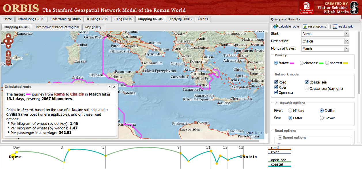 |
| Click for full size image. |
Applications for Education
While you could certainly have students use Google Earth to map distances between settlements in the Roman Empire, ORBIS is a step above that because students can calculate travel times and distances according the modes of transportation that were available during the Roman Empire.
0 comments:
Post a Comment